Weavers', Boudicca, Marriott's Way and Holy Trail
WEAVERS' WAY
.
WHAT TYPE OF TERRAIN IS ON THE WEAVERS' WAY?
The first half of the race starts at Acle recreation ground and goes out onto farmers fields almost straight away. The path is good for the first mile and a half and then after passing through Upton green the path heads back towards Acle bridge through some woods and a riverside path. This can be very slippery and muddy, especially if there has been rain before the race so for this reason we recommend trail shoes and please mind your footing. It is tempting to go fast at the start of the race but please take care here. The mud only goes on for about half a mile and then after that the footing is pretty good.
After crossing Acle bridge you will be running on riverside paths alongside the river Bure. This is mostly pretty good but you may encounter rabbit holes and occasionally hoof prints from horses so please just keep your eye on the trail.
After Potter Heigham you will cross the medieval bridge and run on another path that follows the river Thurne to Heigham sound, this is usually pretty good running but in wet weather can be slippery and the grass can be long in places. This doesn’t go on for too long as the path curves around to the left and you will then run up a slight rise to follow the woodland path next to Heigham sound and Hickling broad. This is a pretty part of the course and a bird watcher's paradise so keep your eyes peeled for herons, birds of prey and wildfowl.
The path exits onto quiet roads at Hickling and you will stay on quiet roads all the way to Stalham. After Stalham the path is a disused railway which is an excellent surface in all weathers. Then back onto some country roads to North Walsham. The trail goes off road again but on good surfaces to reach the A140 above Aylsham. After Aylsham the route is superb. After the village of Silvergate you will enter Blickling Hall estate. The hall is stunning, the grounds beautiful and it is a real privilege to run through here. After Blickling you pass through Erpingham, Thwaite and Hanworth all delightful quiet villages and will eventually arrive at Aldborough. This marks the start of your last push to the finish. The trail leads from here to Felbrigg hall. If you are here in daylight you are doing well, if you are here in the dark you haven’t got far to go.
You enter the grounds via an old woodland and then alongside the lake to then run across the front of the hall and out into the village of Felbrigg. After Felbrigg the running is easy and with a nice bit of downhill into Cromer for tea and medals..
When you reach Cromer you can stop running. You will have conquered the Weavers’ Way!
BOUDICCA WAY
Hol
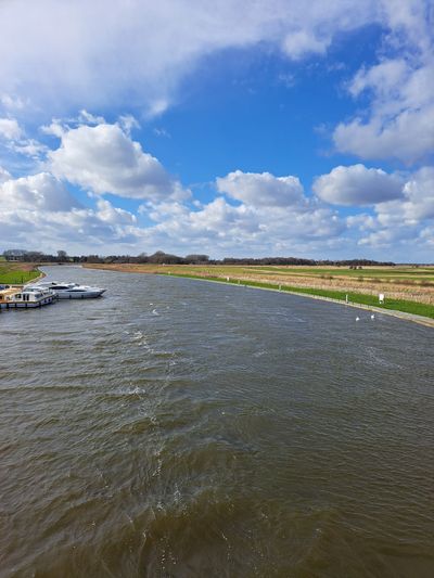
The River Bure at Acle
Weavers', Boudicca, Marriott's Way and Holy Trail
Weavers' Way 50km and 100km
Weavers' Way 50km and 100km

The Weavers’ way is a 61 mile long distance path from Great Yarmouth to Cromer. In this race you will run the whole distance in the 100km or the last 50km of the path from Stalham to to Cromer.
The path is named after the Flemish weavers who used this trail to go from farm to farm collecting wool during the medieval period. This accounts for the rather zig-zag nature of the path.
The big yarn making centres of East Anglia were at Aylsham, North Walsham and Worstead. Aylsham linen was once famous across the UK and was made from the wool of local black sheep. You will pass through Aylsham and North Walsham during the race
Boudicca Way
Weavers' Way 50km and 100km
The Boudicca Way passes through the beautiful, unspoilt rural countryside of South Norfolk and the Waveney Valley. It is named after the legendary warrior Queen of the Iceni, whose tribes once inhabited the area, and runs for approx 36 miles between Norwich and Diss. Running roughly parallel with the old Roman 'Pye' Road, now known as the A140. A detour can be taken to view the remains of Venta Icenorum Roman town at Caistor St Edmund and picturesque villages such as Shotesham, Saxlingham Nethergate and Pulham Market are also visited.
The Way starts and finishes at mainline railway stations so makes it perfect for those looking for sustainable travel options. The route is way marked with pink arrow.
We use the Boudicca Way for 2 of our races, one going from Diss to Norwich (South to North) and one going from Norwich to Diss (North to South). The terrain is a mix of quiet country lanes and beautiful trails. The villages are pretty and the trail is surprisingly rolling by Norfolk standards.
It is one of the easiest routes logistically as the start and finish are on the same trainline with a journey time of 15 minutes and parking at either end.
Marriott's Way
Marriott's Way is a long distance path that run from Norwich to Aylsham. A very popular cycling, running and walking path with mixturea of tarmacs paths and tracks
Holy Trail
Rebel and Realm
Combining Coastal Trails, the Via Beata and the new Kings Charles III England Coastal Path
Rebel and Realm
Rebel and Realm
Rebel and Realm
A new trail marathon for Norfolk, starting and finishing in Diss. Combining the Angles Way, Boudicca Way and locala connecting footpaths.